What would you like to see in an improved Dundas Park?

Council officials from the parks and greenspaces team are consulting on plans to improve Dundas Park.   This comes after significant funding was secured and which can be used to leverage in further grant funding from other sources so significant improvements can be made.

They are very keen to hear what local people think on three different options.

Your can see the three different options

Dundas Recreational Ground SQ-Layout1

Dundas Recreational Ground SQ-Layout2

Dundas Recreational Ground SQ-Layout3

Having your say

You can complete the survey here.

The survey is open until 18 July.

One the responses have been compiled, officials plan to make an application for further grant funding by the end of July.

Good news on Bo’ness Road traffic campaign

We wave some good news on our work to address the traffic concerns in Bo’ness Road.

Thank you to everyone who came along to last week’s public meeting with the Transport Convener. We know people left frustrated at her lack of willingness to consider Bo’ness Road as a special case.

However, immediately after the public meeting, the local Neighbourhood Partnership met. This is a group made up of councillors and local community representatives. During that meeting, we reviewed the next round of community funding which is available from the Council for us to prioritise small local projects. This included that ‘local roads fund’.

The local transport manager, who sat through the public meeting and heard the views of local people, recommended that money be allocated to fund 50% of the expected cost to install a full pedestrian crossing on Bo’ness Road.

This sets aside £20,000 and paves the way to have discussions with other organisations like Transport Scotland about match funding. We can also use this money to make attempts to negotiate a contribution from the Council’s road safety team.

We are certain that we are in this situation as a direct result of the efforts by the community and the passion and concern shown on this issue at the public meetings. We will be keeping up the pressure on how to find the rest of the funds.

Back our campaign to save Queensferry and Kirkliston’s hospital bus link

Click here to sign our petition to save the 22A bus to St. John’s.

First Bus has announced proposed changes to its services in West Lothian.  These would end the current 22A bus service between Queensferry, Kirkliston and St. John’s Hospital.

We think it is unacceptable that these communities could be left without a regular and reliable bus service to and from St. John’s. With rising populations, Queensferry and Kirkliston need this important link now more than ever.

Even those who don’t need to use the bus themselves will know others who depend on this bus to get to and from our important local hospital.

First Bus say they are consulting and want to hear local views before a final decision is taken.  We need to send the company a message – loud and clear – that the 22A must be saved.

This is why we have launched a new petition.  It takes just five minutes to add your name.  Please add your support today.  Thank you

Click here to sign the petition to save the 22A

Queensferry High School project to start 30 April

The project to build the new Queensferry High School is due to begin on Monday 30 April. The first phase of the works will run to March 2020 and involve the building of the new school building.

A new access road will be created from Station Road.  This will require traffic management in the form of temporary traffic lights to carry out these works. From the end of May, work will start on the drainage and foundation works with the start the erection of the structural steel frame in September 2018.

As the main contractor for the work, Morrison Construction promised to keep the local community informed and has issue the first of what is intended to be a regular newsletter update. You can see this by clicking on the images below.

Queensferry High Street project – have your say by 2 May!

We are delighted to see the £1 million project to redevelop and improve the Queensferry High Street finally making progress with the first public consultation.

The budget for the project was approved by the City of Edinburgh Council back in January 2016 with the aim to improve the local infrastructure, parking control, traffic management and pedestrian areas of the High Street.

However, the project was delayed following staffing changes in the Council.  A commitment to making progress was given after we complained about the delays at a full meeting of the Council last October.

Since then, project consultants Ironside Farrar have been appointed and a project management board established involving representatives of the community.

The first stage consultation is underway.  At this stage the consultants want to hear your views about the High Street, what you want kept and what you would like changed.  There will be further consultation on more specific proposals in June and then September.  Actual construction works are likely to commence around February 2019 and be complete in October 2019.

You can see the presentation by clicking on the slides below.  You can submit comments to mail@ironsidefarrar.com marked ‘FAO The Queensferry High Street Team’.  Comments for this stage of the consultation need to be submitted by Thursday 2 May.


South Scotstoun housing approved – Lib Dem member voted to refuse

The planning application to build 340 homes on the South Scotstoun fields was before the planning committee this morning.

As before, we submitted a request for a hearing so we could speak before the committee and highlight local concerns before a decision was taken. We were very grateful to the Lib Dem member of the committee, Cllr Hal Osler for formally moving that the hearing request be accepted and heard. However, the matter went to a vote and was lost by 4 votes to 7.

The committee then had to consider the application. We are sorry to say the application was approved by 8 votes to 3.

Again, we are grateful to our Lib Dem colleague Cllr Osler for voting to refuse the application. All SNP, Labour and Conservative members of the planning committee voted in favour of the application.

There remain extremely serious issues around roads and infrastructure to support all this new housing.

Whilst today’s decision (and that from a few weeks ago) didn’t go the way we would like, we’ll be working hard to try and ensure the improvements which are so badly needed are put in place.

Fury as Council refuses action on Bo’ness Road

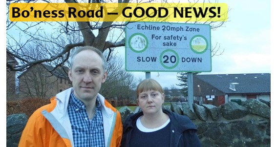
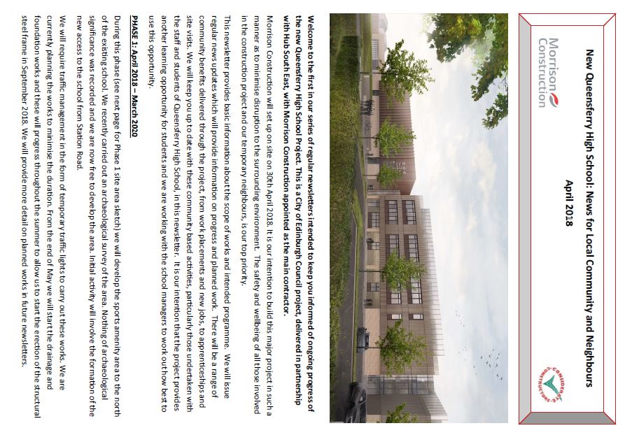
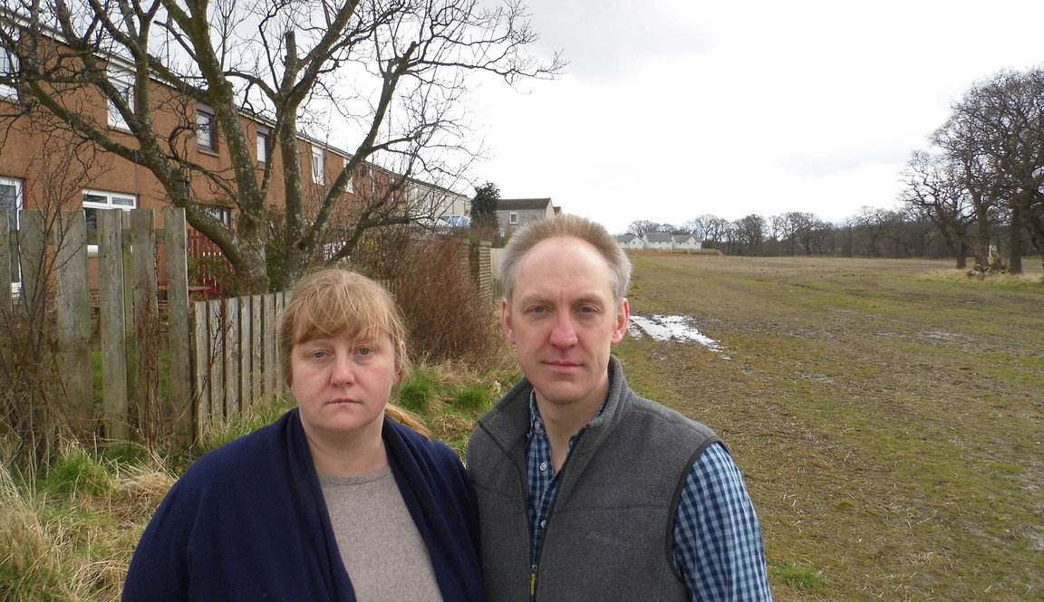
Despite a petition of over 1,200 names and a well attended public meeting, Council road safety officials have said they intend to take no substantive action the speed of traffic on Bo’ness Road.

We are extremely unsatisfied with the lack of commitment to making tangible improvements with our requests for a pedestrian crossing or traffic calming measures having been declined. This position has been endorsed by the SNP/Labour Administration as it has been mentioned briefly in a Council paper from the Transport Convenor.

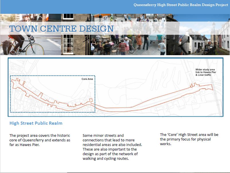
Considering the strength of local opinion and the numbers who both completed the survey and who attended the meeting, this is clearly a very real concern for the community. Even if the monitored numbers don’t result in a score high enough for the standard process of recommending improvements, the very unique nature of Bo’ness Road, being so close to the much faster routes at the Queensferry Crossing, and the layout of the road being so long and wide, should all have been enough to secure real changes for the safety of our children and vulnerable residents.

We have now written to the Convenor of Transport, and to Cllr Work as the Administration’s representative in Queensferry, inviting them to attend a follow up meeting to explain their reasons and justify their position, as well as take questions from the many residents who are looking for answers. We look forward to their response and intend on booking a meeting, back at the school, as soon as possible.

In the meantime the Campaign Group, led by Babs Shaw, wish to add their voice to ours and to raise their concerns at the highest political and managerial levels of the Council.

  • Here is the full response from the road safety team

Can the crossing assessment times be altered?

No as the base data which is used to assess if a location is suitable for a crossing is known as the PV2 value.  This is a nationally recognised value that indicates the number of passing vehicles and pedestrians.  Pedestrian and vehicle counts are taken over the peak hours of a week day between both 7am to 10am and 3pm to 6pm, and avoid any school holidays or other factors which may skew results. These times generally represent the busiest periods for pedestrians and vehicles  and give the highest assessment results. These times also include school entry and exit times.

Can we have a pedestrian crossing outside the school?

The assessment process generates an adjusted PV2 value, which is used to determine whether improvements are required to crossing facilities and the most appropriate type of crossing facility for that location. The predominant factors in the calculation of this value are the volumes of pedestrians crossing the road (P) and passing vehicles (V) that are recorded in the surveys that are undertaken. These give a base PV2 value, which is then adjusted by a series of factors that take account of:

• the numbers of children using the crossing point

• the numbers of elderly and disabled people using the crossing point

• the numbers of buses & HGVs passing the crossing point

• pedestrian accidents within the last three years

• the width of the road

• the speed of passing traffic

• the number of nearby trip-attractors (e.g. schools, shops, leisure and community facilities etc.)

A location with an adjusted PV2 value of 1 or higher (2 or higher on a dual carriageway) would be considered for a puffin crossing, locations with a value of 0.3 or higher would be considered for a suite of measures that includes a zebra crossing, a refuge island or pavement build-outs.  If a very low PV2 value is achieved no additional crossing facilities may be recommended.

I can confirm that a crossing assessment was recently undertaken in October 2017. This resulted in a low adjusted PV2 value of 0.110. Therefore, no additional facilities will be implemented at this time as the build outs that are in place are acceptable for the crossing demand.

Can speed cameras be installed?

Police Scotland is responsible for the delivery and operation of the Scottish Safety Camera Programme, which is funded by the Scottish Government.  The Scottish Safety Camera Programme Handbook 2015 sets out the rules and guidance for the programme in Scotland, including criteria that apply nationally and require to be satisfied before safety cameras can be considered for installation.

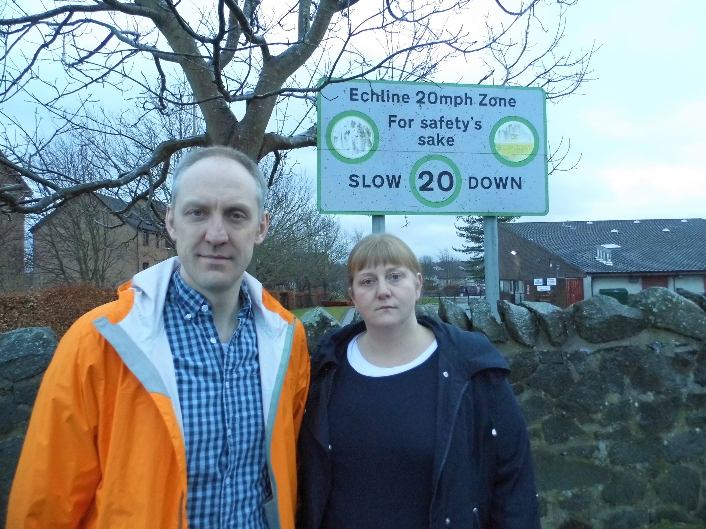
Can Bo’ness Road have a 20mph speed limit applied?

The current 20mph network was approved by the Transport and Environment Committee on 13 January 2015. In developing the network, a consistent approach was applied across the city using a set of criteria to establish a network of 20mph streets in the city centre, main shopping and residential streets while retaining a strategic network of roads at 30 and 40 mph on key arterial routes.

The introduction of the citywide 20mph network is a major project for the Council, taking in a high percentage of streets. It is likely that as a result of surveys, monitoring and public feedback, there will be some post implementation adjustments. This may involve further changes to speed limits, both within 20mph zones and possibly on some strategic routes which have retained higher speed limits. Comments raised through this consultation in relation to a reduction to 20mph are being recorded which will form a review of the project. The results of this review will be reported to Transport and Environment Committee in Spring 2019.

I have passed on to the 20mph team the desire that those present at the meeting had for Bo’ness Road to be reduced to 20mph.

Carry out Speed Survey’s on Bo’ness Road and Builyeon Road to influence enforcement if required.

Bo’ness Road (outwith PT20mph) shows an average speed of 31.1mph over 7 days. This does not raise any cause for concern on a road with a speed limit of 30mph.

Bo’ness Road (within PT20mph) shows an average speed of 27.8mph over 7 days. This again does not raise any cause for concern on a road with a speed limit of 30mph. However, the 5 day average recorded speeds during school entry and exit times, when the PT20mph limit was operational was 26mph. This therefore shows that enforcement is required to remind drivers of the part time 20mph limit.

The locality team have agreed to cut back any vegetation that may be affecting drivers visibility of the part time 20mph signage.

Can Vehicle Activated Speed Signs (VASS) be installed on Bo’ness Road?

A report was presented to the Transport, Infrastructure and Environment Committee on 4 May 2010, which approved a set of criteria for the future use of this technology. Unfortunately, Bo’ness Road has failed to meet the criteria for VASS to be installed.

Can links to all council approved processes that the Road Safety team work to be provided?

Pedestrian Crossings – http://www.edinburgh.gov.uk/download/meetings/id/8638/pedestrian_crossing_prioritisation_process

VASS Report – http://www.edinburgh.gov.uk/download/meetings/id/2337/vehicle_activated_signs_-_pilot_study_results_and_recommendations_motion_by_councillor_jackson

Independently of the 20mph Programme, the Road Safety Team undertakes an annual collision investigation into all streets within the City. From this analysis it is possible to determine locations where the collision rate is giving cause for concern and where road safety remedial works may require to be implemented.

These remedial works are targeted at priority locations and spending is targeted towards areas which will have the greatest potential for collision reduction benefits. This needs to be seen against a level of almost 1200 collisions in Edinburgh every year.

Bo’ness Road has not been identified as a site for concern through this process.

Why do other schools in South Queensferry have traffic calming surrounding them?

The traffic calming around the other schools in Queensferry was installed as part of the Safer Routes to Schools programme, which was carried out in the mid-2000’s. The streets surrounding Echline Primary (excluding Bo’ness Road as it was classed as a ‘main route’) were all included as part of this work.

Getting action on pot holes and broken pavements

Today was budget day in the Council. Along with our fellow Liberal Democrat councillors, we proposed an extra £4.5 million to sort out the disgraceful state of roads and pavements in the city. This was 5 times what the SNP/Labour administration were proposing in terms of additional investment.

Kevin used his budget speech to talk about why this investment was so important to sort out pot holes and broken pavements in many of the areas we represent.

Unfortunately, SNP and Labour councillors running the city rejected our proposals. We will keep fighting to get action in our communities but that job has been made more difficult by the refusal of the administration to invest the money needed.

Major roadworks planned for Barnton junction and Queensferry Road (Feb/Mar 2018)

We have been informed of major road works to resurface parts of the Barnton junction and Queensferry Road.  These will start on 26 February and involve closures, temporary traffic lights and diversions so it is important for people to plan ahead.

The works will take place in the evenings and at night in order to avoid the busy peak traffic periods.  The roads should be open as normal during the day.

Details of local bus diversions can be found here


  • 26 February – 11 March: Barnton junction resurfacing


The junction carriageway on the Queensferry Road at the junction with Whitehouse Road is to be completely resurfaced. These works should take around two weeks to do but could be completed earlier if there is good weather.

The works will start at 7pm each weekday evening with the noisier operations stopping at 11pm.  Quieter work will continue into the early hours of the morning. This will allow the works to be carried out during times of low traffic volumes and therefore reduces the risk of congestion and delay.

The junction will be open to traffic from 7am-7pm each day as normal.  However, when work is being carried out in the evening and at night, the junction will be closed to east bound traffic along Queensferry Road.

A diversion system will therefore operate along Whitehouse Road, Gamekeeper’s Road and Cramond Road South when the east bound part of Queensferry Road is closed.  Residents here should therefore expect a significant increase in city bound traffic during this time.  You can see a detailed map showing the diversion arrangement here.

Map showing the diversion during Barnton junction works

  • 12 – 25 March: Queensferry Road surfacing

The second part of the resurfacing works will take place on Queensferry Road near the Parkgrove shops.

These are due to start on 12 March and will take two weeks, subject to weather.  Just like the Barnton junction works, the resurfacing will take place each weekday evening from 7pm and with the noisier operations stopping at 11pm. Again, this will allow the works to be carried out during times of low traffic volumes and therefore reduces the risk of congestion and delay.

The junction will be open to traffic from 7am-7pm each day as normal.  However, when work is being carried out, the entrance to Barnton Park Drive from Queensferry Road will be closed off.  Access to and from the Barton Park estate will have to be via Barnton Grove and Whitehouse Road.

The flow of traffic along Queensferry Road will be controlled using temporary traffic lights and a contraflow.  You can see a detailed map showing some of these arrangements here.

Map showing works and contraflow arrangements on Queensferry Road

Whilst we are pleased to see that works are being timetabled to try and minimise disruption, the nature of the junction and the Queensferry Road means we still expect delays.  We would encourage all our constituents to plan ahead and allow more time for their journeys.

Changes made to South Scotstoun housing plan

All those who (like us) objected to the proposed new housing development at South Scotstoun should have received a notification about planning application changes recently submitted by Taylor Wimpey.

The original application was submitted back in December 2016. Since then, it has been subject to review by planning officials before it going before the Planning Committee for a final decision.

In terms of the recent changes made:

  • The general layout remains broadly the same, although the number of units has actually increased slightly to 341. There has been a significant reduction in proposed car parking space to 592 spaces from the original 792 spaces.
  • The main changes have been to the design and layout of the houses and flats next to the central area around the proposed public open space, where the flats are and the link south to the east/west cycle way. The orientation of the houses on the far east of the proposed development have also been altered.
  • There have been other minor changes in relation to orientation of some units within the plots to provide better overlooking of spaces and avoid blank gables.

However, the overall proposals remain very similar to that submitted before. We will let people know when a date is set for the application to go before the planning committee.

You can see all the plans via this link.